A Break on the Way to the Park (J)
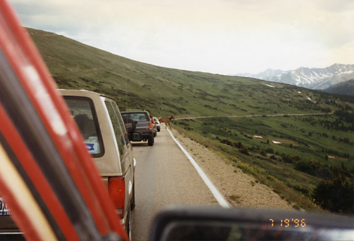
An Elk Stopping Traffic (A)
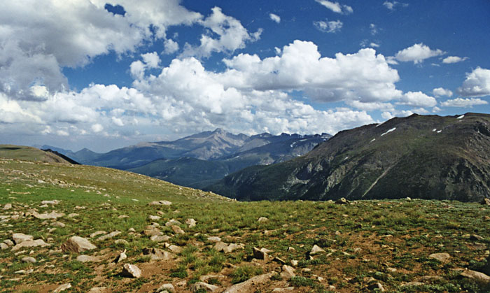
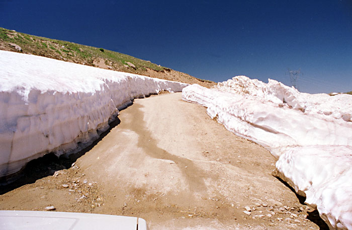
Milner Pass (J)
Our 1996 Trip Across the USA Page 22
Back to Jon Vermilye's Photo & Trip Page
A note on Photographs - All of us are taking pictures - I'll do my best to give photo credits with an initial, but if I miss one be sure to let me know! J = Jon, D = Don, A = Anne & C = Carol. You can usually tell Anne's - her camera puts the date on the image! Also, most of the images are scans of old & faded prints, so the quality may not be all that hot.
July 19 - Rocky Mountain National Park & Leadville, CO (193mi)
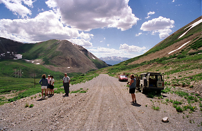
We headed out early, deciding to take US 34 through Rocky Mountain National Park. What a road! There are parts that drive along a ridge so narrow you can see steep drop offs on both sides. Not so good for those nervous about heights, but what a view.
|
|
|
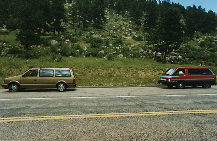
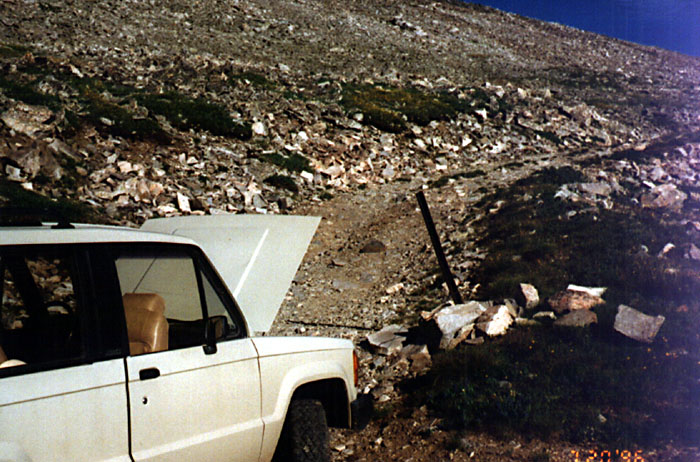
A Break on the Way to the Park (J) |
An Elk Stopping Traffic (A) |
Milner Pass (J) |
After going through the park, we caught US 40 to I 70, then CO 91 into Leadville. Some friends from Oswego moved to Leadville to be closer to real skiing. We are going to get the grand tour from Dick & Anne. Denver is called the mile high city - Leadville is almost two miles high at 10,152'! We headed for the Sugar Loafin' Campground just outside town, campground altitude - 9696'. Just down the road is Mount Massive, both the mountain (14,421) & North America's highest golf course (9680'). We are in Sites 60 & 61. Both of Dick & Anne's kids Sean & Keith worked at Sugar Loafin' while going to high school. It is interesting camping at this altitude - although it is warm while the sun is up, it was in the low 30's overnight. I think we will take Dick's offer to stay at his house tomorrow night!
July 20 - Leadville Old Mines & Mosquito Pass (0mi)
When I got up this morning I met our next door neighbor. He was cleaning a bunch of little cups - seems he spends his summers digging through ghost town privies & behind assay offices looking for the vessels used to test ore samples. He cleans up the unbroken ones he finds & sells them during the winter. He had hundreds out drying - he says he makes a good living doing it & gets to spend his summers exploring all over the west. Sounds good to me. He gave me a sample.
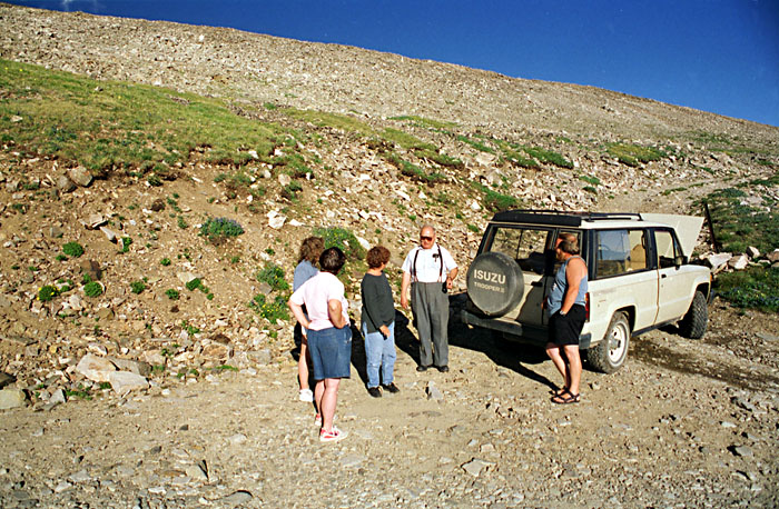
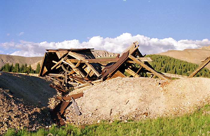
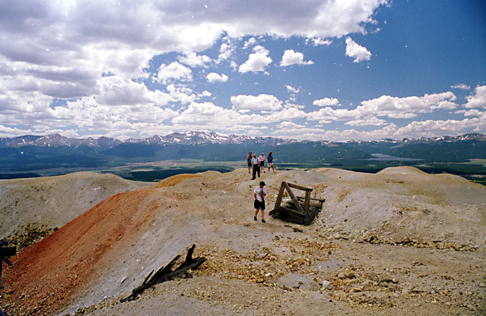
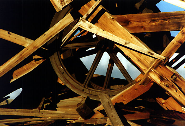
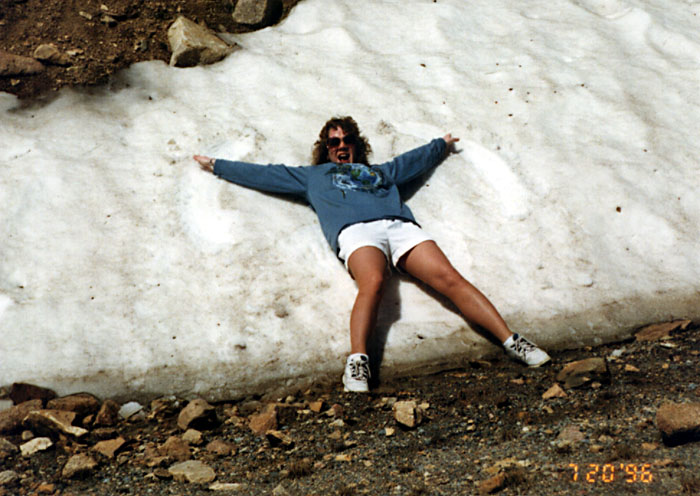
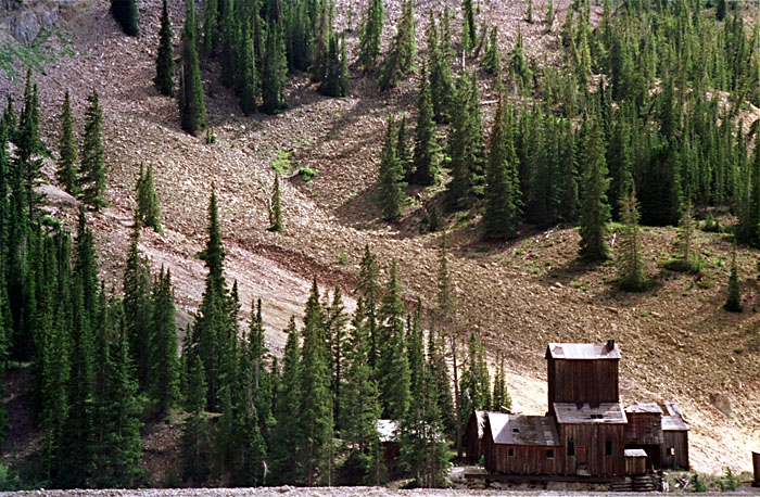
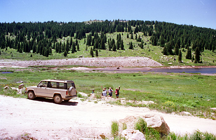
We didn't do much driving (at least with our vans) today, other than from the campground to Dick & Anne's. They crammed all of us into the their Isuzu Trooper for our trips around Leadville. We started out with a drive out 4th, 5th & 7th St which goes to all the way to Alma, a town over the mountains to the East. In fact, when we came out to Leadville for a visit in the '70's, we almost tried to take the road - it looked like a good shortcut, at least on the map - AAA listed it as a county road. We finally decided it would be best to follow Dick's directions. Good thing we did - the road doesn't open until July, and even then is only passable in a 4 wheel drive driven by someone with nerves of steel! It goes over Mosquito Pass, at 13,185 the highest open pass in the US. Although on this trip we didn't go over the pass, we made it most of the way there. Lots of snow & great views. Many abandoned mines - we stopped at one to dig for gold! Found lots of it. We're RICH! Oh, it's fool's gold - gee, easy come, easy go...
 |
 |
 |
Sugar Loafin' Campground (J) |
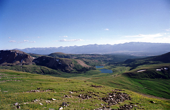
View from Sugar Loafin' (J) |
7th St / Mosquito Pass Road (A) |
 |
 |
 |
7th St / Mosquito Pass Road (J) |
View from Mosquito Pass (J) |
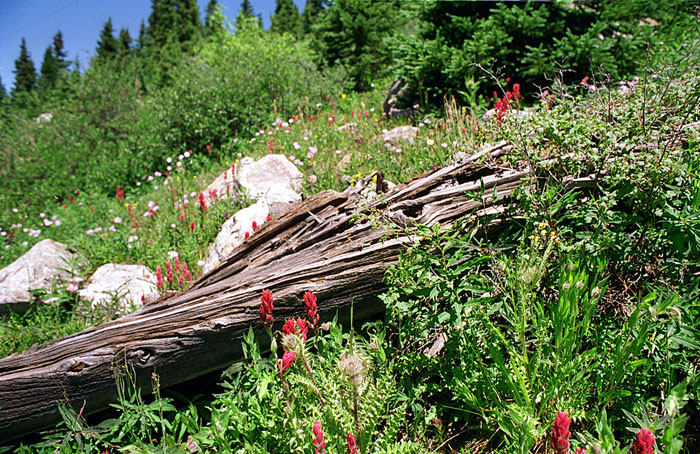
Flowers (J) |
 |
 |
 |
Fanny Rollen's Mine, 7th St (J) |
Mining for Gold (J) |
An Old Mine Head (J) |
July 21 - Hagerman Pass, Hanging Lake (0 mi)
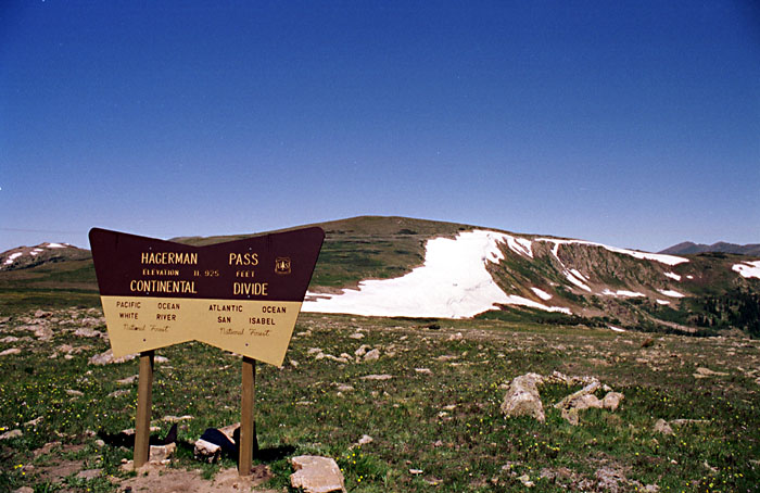
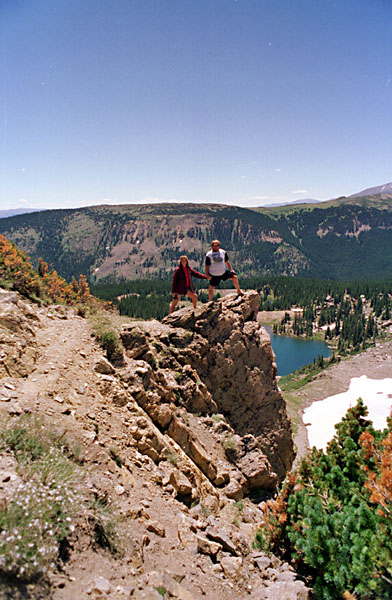
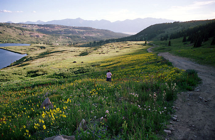
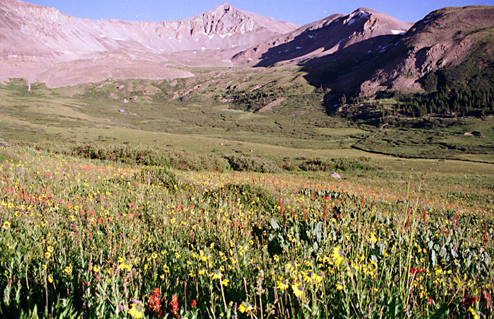
Today we started out early, heading for Glenwood Springs & Hanging Lake on what starts out as Turquoise Lake Road, and changes its name often. Some examples of other names include County Rt 40, Hagerman Pass Road, Ivanhoe Lake Road, and County Rt 4, going through places like Hell Gap, Steller Park, Chapman, Nome, the Frying Pan River, Thomasville & Meredith. Meredith is the only town that actually exists. Although this is a better road than the one going to Mosquito Pass, I'm not sure my van would make it. We did meet someone coming the other way in a Toyota Yota just like Don's! On the way we went through Hagerman Pass. Usually, any time Don finds something to hang off of, go out on, or any precipice to make Anne nervous, he's there. This time he managed to drag Anne out with him. If you look close, she is barely smiling... After crossing Hagerman Pass and letting Anne out to make snow Angels in July, we stopped for lunch at Meredith overlooking a beautiful field of flowers. It is amazing to see how much the season changes with altitude. In one trip we went from winter through spring & well into summer!
 |
 |
 |
Hagerman Pass 11,925' (J) |
Snow Cut Hagerman Pass (J) |
Anne Making Snow Angels (A?) |
 |
 |
 |
Hagerman Pass (J) |
Old Mine (J) |
County Rt 40, CO (J) |
 |
 |
 |
Iowa Gulch (J) |
Lunch Stop Meredith, CO (J) |
County Rt 40 (J) |
 |
 |
 |
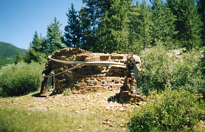
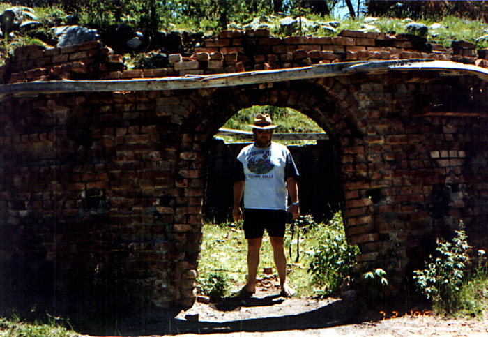
A Charcoal Burner Rt 40 (C) |
Don in a Charcoal Burner (A) |
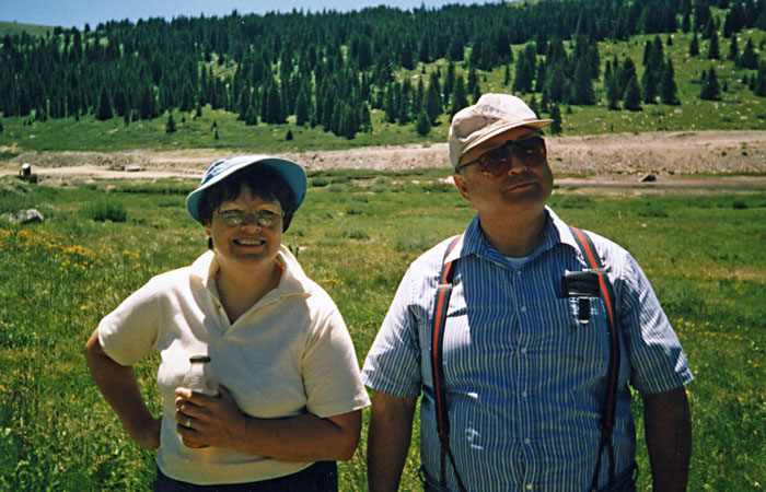
Anne & Dick (C) |
After lunch we continued towards Glenwood Springs & Hanging Lake. We stopped to look at some burned out charcoal burners near the end of what is now called County Rt 4.
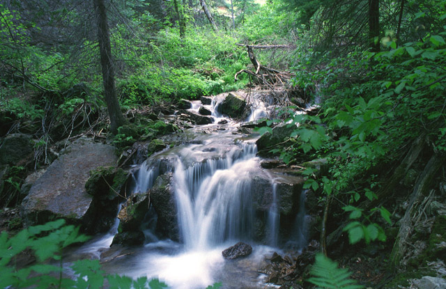
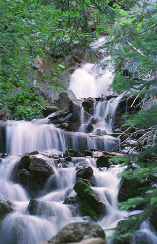
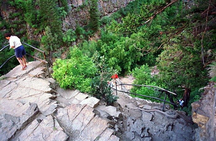
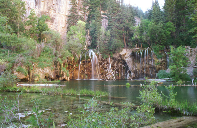
Hanging Lake has its own exit off the East bound side of I 70 - the only way you can get to it. Although not a long hike, you gain close to 1000' in about 1 mile. It will give your legs a workout. The last couple of hundred feet is pictured below - quite a climb. There is a small stream that is filled with waterfalls & cascades that flows from the lake and runs along side most of the trail; one of the most beautiful walks I've been on. The lake itself is well worth the trip without the stream - the stream makes it perfect!
 |
 |
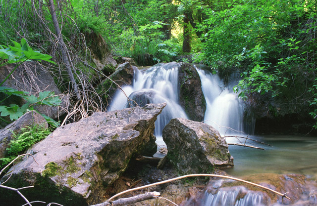 |
Hanging Lake Trail (J) |
Hanging Lake Trail (J) |
Hanging Lake Trail (J) |
 |
 |
 |
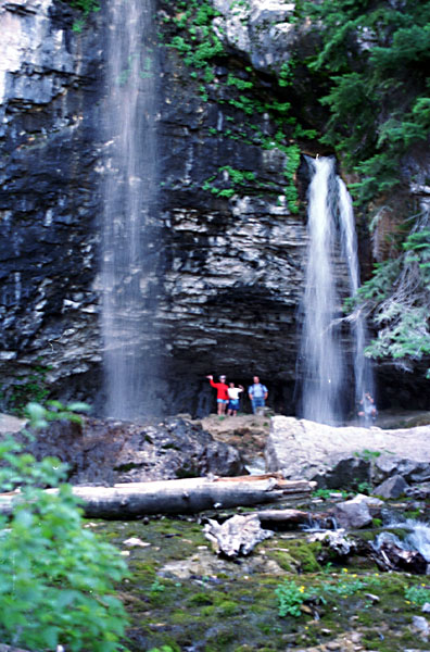
Anne D, Anne H & Don - Almost to the Lake (J) |
Anne, Anne & Dick - Spouting Rock (J) |
Hanging Lake (J) |
We were a bit worn out by the time we got back
down - we stopped for dinner in Glenwood Springs & took I 70 & US
24 back to Leadville. We hated to say good bye to Dick & Anne & Leadville
- they have many more places to show us, but the trip must continue. Our
next major
stop is Yellowstone National Park.
Next
Previous
This page is maintained by: vermilye@oswego.edu
Last Update:
March 21, 2012