Letchworth State Park Visit, 2011
Letchworth Visit 2020
We decided to take a day trip to Letchworth State Park with some friends, Dick & Anne Dougherty. We haven't been there since our daughter Karin was going to college at Geneseo, and is has been even longer for Dick & Anne. It is about a 2 hour trip from their place in Fair Haven.
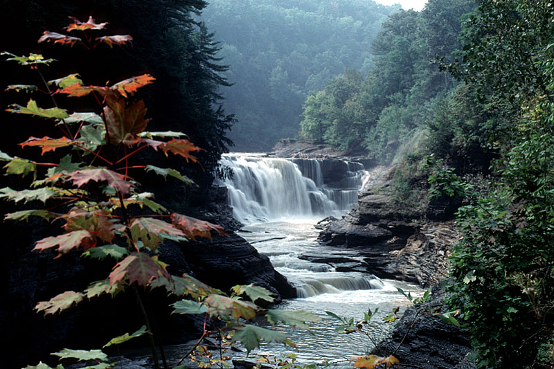
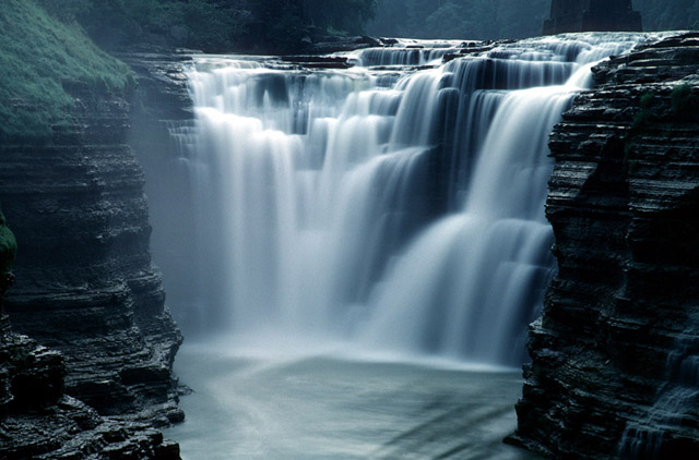
The Last time were were there I was shooting with a Nikon F4 and Kodachrome (sniff, sniff, its going away) film. Today it is with a Nikon D300. There was one shot I wanted to get again; never knew it would be so difficult! Here are a couple of the photos from that trip:
|
|
| 1994 Kodachrome | 1994 Kodachrome |
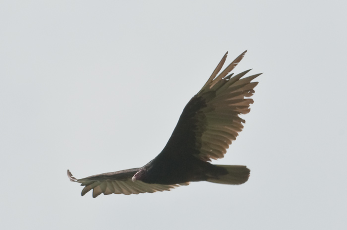
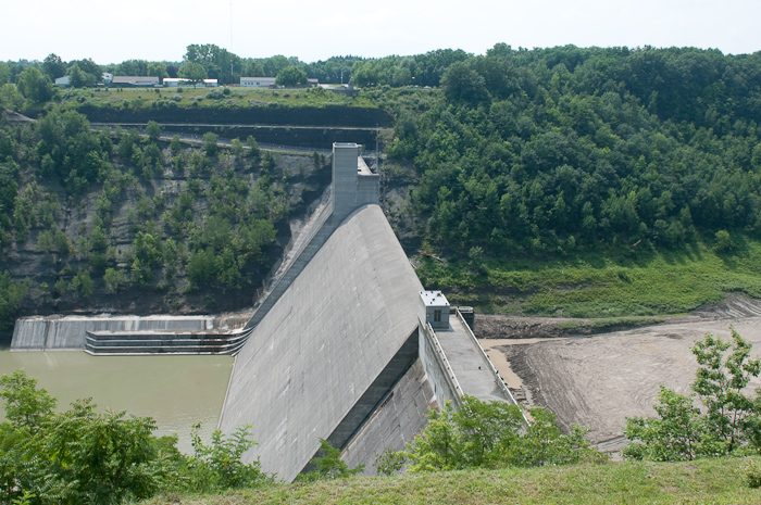
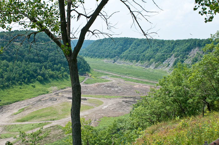
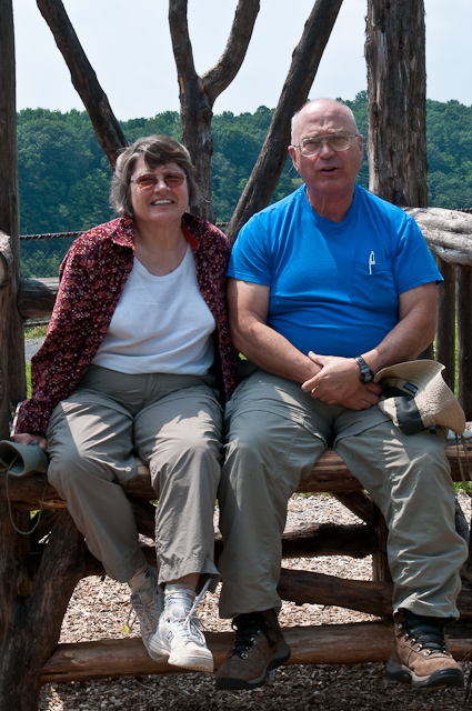
Anyhow, we entered the park at the Mt. Morris entrance. New York State has a deal for those over 62 - if anyone in the car is a NY resident, there is not charge for entering the park on weekdays. One of the perks of being retired! We stopped just inside the park at the Mt Morris flood control dam. A great place to check out Eagles, Hawks, and Turkey Vultures gliding over the valley. Unfortunately, all I got to photograph were some Turkey Vultures - the Hawks & Eagles were on vacation! The dam is interesting - apparently, the only time there is water behind it is when there is flooding on the Genesee River. Today there was lots of grass growing in the bottom along with some construction vehicles. I'm not sure where the river goes since there is lots of water spilling over the falls, but none going into the back side of the dam. Must be a diversion tunnel somewhere...
 |
 |
 |
 |
 |
| Turkey Vulture | Mt Morris Flood Control Dam | Behind the Dam | Dick & Anne | Morris Dam Parking Area |
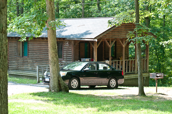
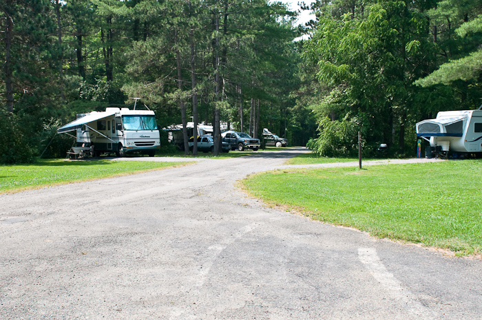
After the dam we stopped to check out some of the cabins & campgrounds. There are five groups of cabins, most with electricity and water, and eight camping loops, no sewers or water hookups, but some with 50 amp electric in the park. Reservations are through Reserve America.
 |
 |
 |
| A Typical Cabin | Cabin Loop C | Camping Loop |
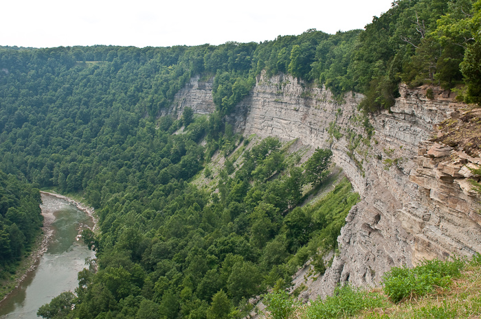
There are many pull offs that overlook the Genesee River Valley:
 |
 |
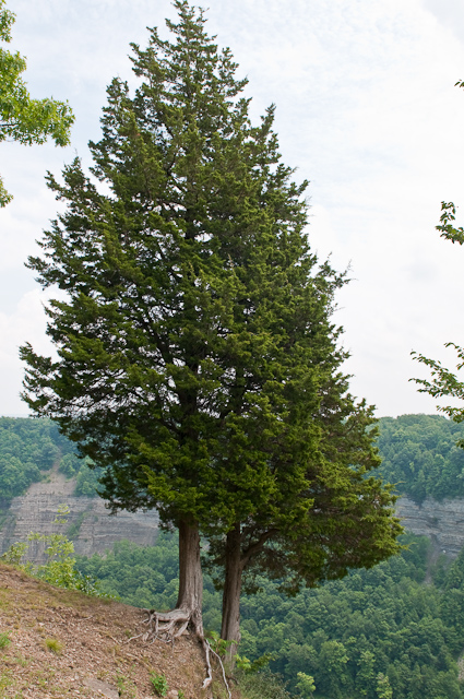 |
| View From a Typical Overlook | More of the Same | Some Cedar Trees |
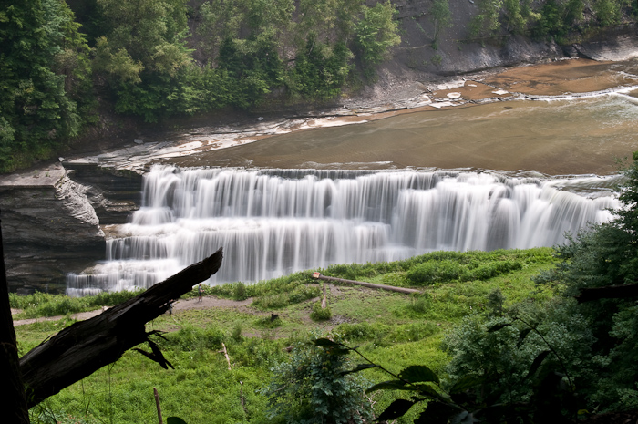
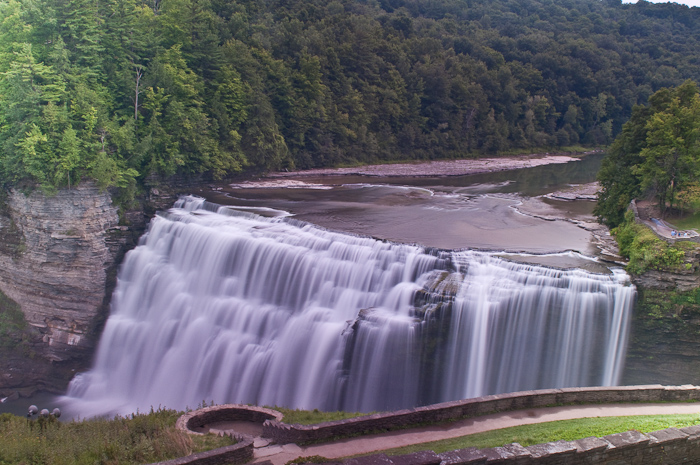
We ate lunch at the picnic ground next to the Lower Falls. After lunch, we took the easy trail to see the Lower Falls since pushing Carol's wheelchair down & up 175 steps seemed a bit out of the picture! Actually, the path to the "easy" trail was not really designed for a wheelchair - it was quite steep, many rocks & washed out areas - quite a workout at the top end, but we managed not to dump Carol!
 |
 |
| Carol & the Van | Lower Falls From Above |
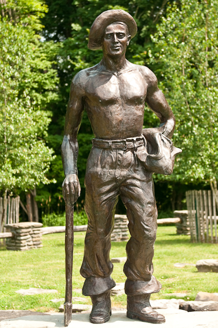
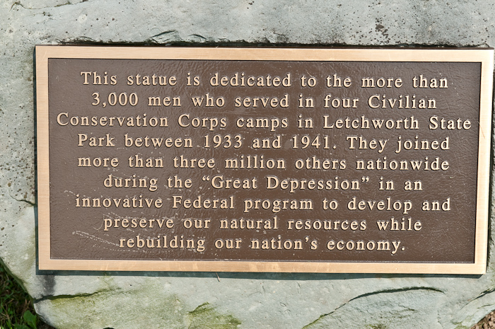
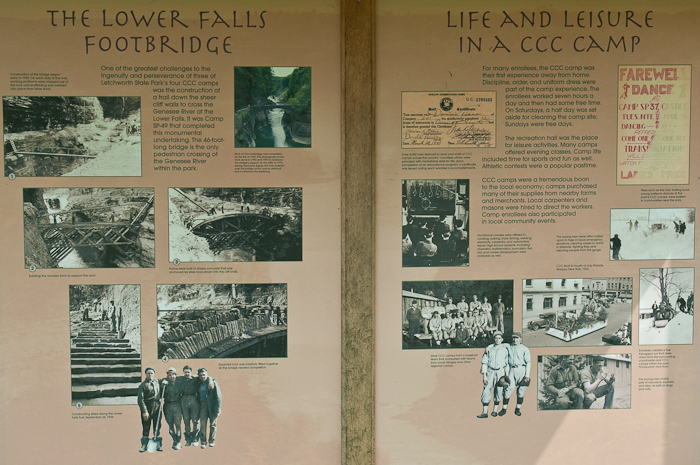
At the other end of the parking lot for the Lower Falls, there is a section of the park dedicated to the Civilian Conservation Corps workers that built Letchworth Park. It includes a statue of a typical worker as well as a couple of displays describing what the corps was, how the worked & what they did:
 |
 |
 |
 |
| CCC Statue | CCC Sign | Story of the CCC | Story of the CCC, Page 2 |
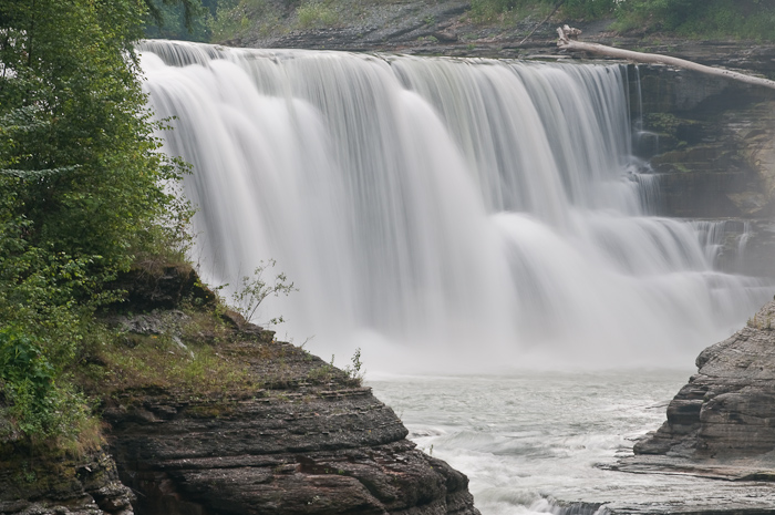
From there we continued up the Genesee River, stopping at the Glen Iris Inn, the location of the Middle Falls.
 |
 |
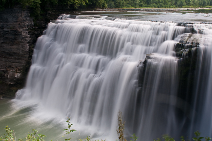 |
| Middle Falls | Middle Falls | Middle Falls |
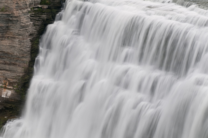
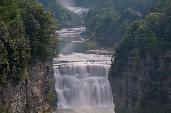
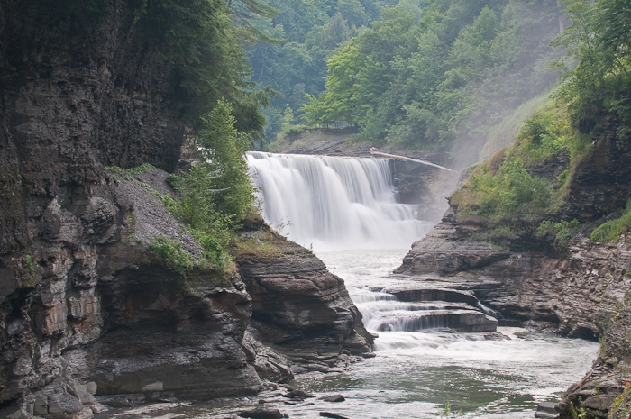
After a couple of photos of the Middle Falls, we drove to the parking lot for the Upper Falls. I think this is a pretty falls, but somewhat spoiled by the railroad bridge just above it. When we reached the Upper Falls, I thought I was going to retake one of my favorite images (the first one at the top of this page). It has been exhibited at the NY State Fair, & I have sold a few copies, but my mistake was not labeling which falls it was (for those that started making photographs with digital cameras, remember, there is no EXIF data for slide film!)
For some reason I thought the image was of the Upper Falls, but there was a bridge that I remembered near the location where I took the photo. Because of the width of the Genesee River at the Upper Falls, there was no way the bridge I remembered could have been there. I decided I must have imagined the bridge (after all, it has been 15 years since the last time we were here) & kept looking for the location I took the original image from. I even rechecked the photo on my iPhone, and finally admitted that it could not have been this falls.
 |
 |
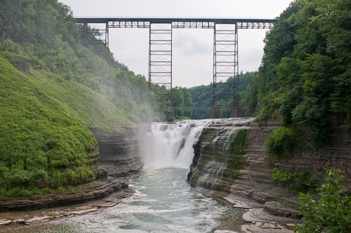 |
| Upper Falls | Upper Falls | Upper Falls & Railroad Bridge |
We stopped at Inspiration Point for a couple of photos - a beautiful view if both the Middle & Upper Falls, somewhat spoiled by the power lines going across the valley (Photoshop can fix it!):
 |
| View From Inspiration Point |
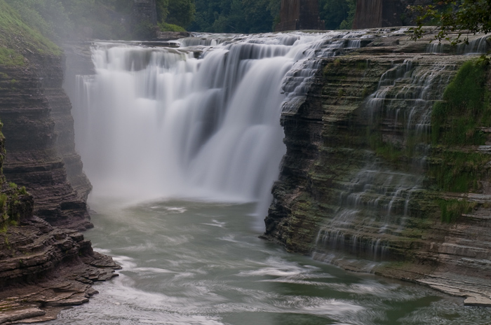
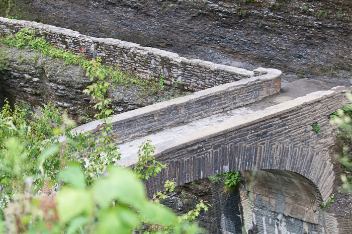
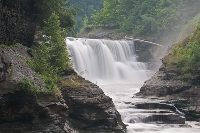
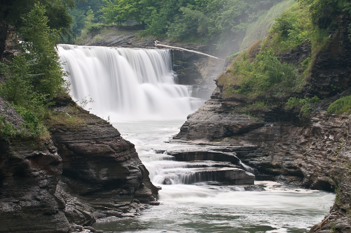
Dick also remembered the bridge from one of his trips to the park, went back to the park office & found a book that included a photograph of it. So... back to the Lower Falls & down the 175 steps to the actual location of the bridge. I'm not sure how we missed it since the snack bar at the parking lot was called the footbridge refreshment center, there was a sign pointing the way to the footbridge parking lot, etc (remember, this is where we ate lunch a few hours before). Anyway, it is amazing how different the Lower Falls looks from a different angle.
|
 |
 |
| Lower Falls From Above | The Footbridge | Lower Falls |
 |
 |
 |
| Lower Falls | Lower Falls | Lower Falls |
After hauling ourselves up the 175 steps, much more work than going down, we called it a day & headed back to Fair Haven & Oswego.
This page is maintained by: vermilye@oswego.edu
Last Update:
October 13, 2020